- Atmospheric / Magnetic conditions and solar data
- Path calculations and map (MUF / OWF / FoF2 NVIS)
- Current activity / spot maps
- G7RAU MUF map (you need a login or use the Live MUF v7 software)
- VHFDX.info map - HF and VHF spots
- WSPR map
- Azimuthal map from DX cluster
- Realtime Ionogram (scroll down)
- FoF2, MUF, OWF in Dourbes (ON)
- VOACAP interface with world map
- NOAA Radio Communications Dashboard
- NOAA solar wind prediction
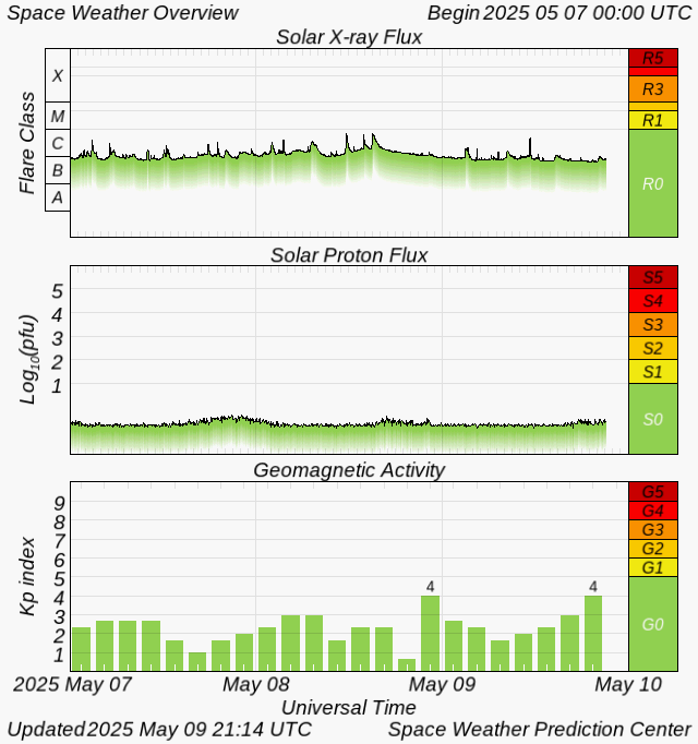
[1] Atmospheric / magnetic conditions
N0NBH solar data
Info on how to interpret the data by N0NBH: pdf fileSolar & geomagnetic conditions
Solar wind

Click here for: solar wind animated
Space Weather Outlook
27-day Space Weather Outlook Table
HRD Log activity map

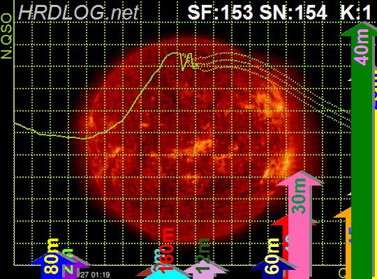


Some interesting HRDLog links
Last week's logged contacts from continent to continent per hour of the day
[2] Current activity overview
PSK Reporter map
HRD Log activity map
[3] Path calculations / visualisations
HamCap
Realtime HamCap map from Germany - DX-Propagation at DF0CG/DR1AF5LEN predictions
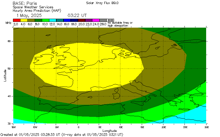
Propagation to selected grid per band from PH0NORecommended HF frequencies (Paris)
Near Real-Time 3000KM MUF map
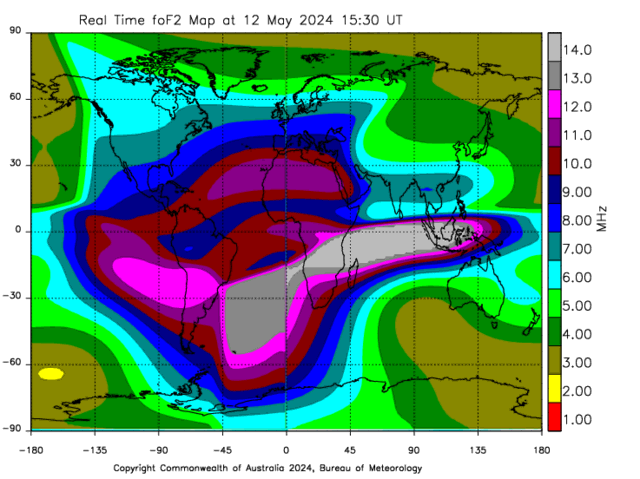
Ionospheric map - critical freq (NVIS)
foF2: the highest frequency which the ionosphere will reflect vertically.
Near Real-Time NVIS Critical Frequency map
Some interesting HRDLog links
Last week's logged contacts from continent to continent per hour of the day